January 22, 2026

Leveraging my expertise as a member of the National Technical Committee tasked with developing the National Manufacturing Industry Resource Atlas, an innovative geospatial platform established through a strategic collaboration between the Ministry of Industry and the World Bank, I passionately advocate for the start of a comparable initiative within the Ministry of Agriculture to enhance sustainable horticulture development
This Resource Atlas serves as a dynamic blueprint for the ambitious goals outlined in the National Horticulture Strategy.
The goal of the national horticulture strategy outlined includes propelling Ethiopia’s horticulture sector from contributing 4.5% of GDP to 12%, boosting foreign earnings from $650 million to $3.3 billion, generating additional employment for 2 million people, increasing the current annual per capita production of fruits and vegetables from 50.2 kg to 102 kg, and sequestering 131 million tons of carbon dioxide into the soil and the biological content of crops over the next decade.
As a country blessed with diverse agroecological zones, Ethiopia stands on the cusp of horticultural dominance, exporting vibrant fruits, vegetables, and flowers to discerning markets in the Middle East and Europe. Yet, to unlock this potential, we must embrace innovation not just in cultivation but in strategic planning.
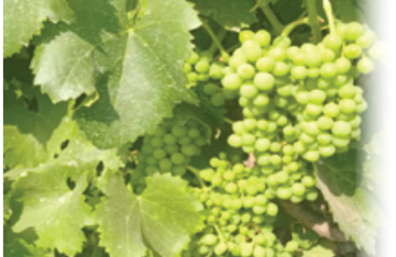
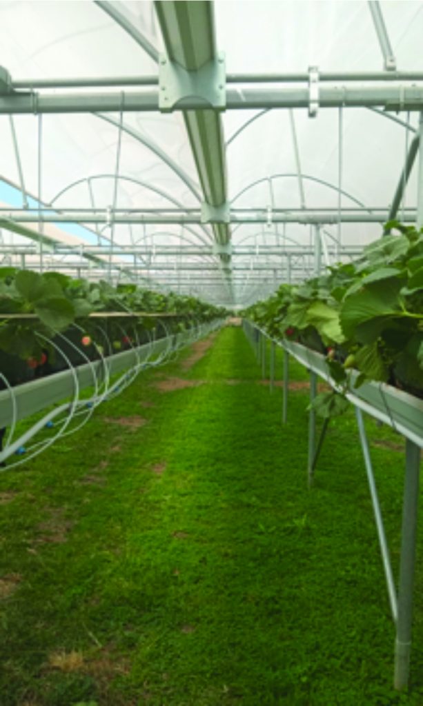
Ethiopia’s horticulture sector is a weaving of untapped promise. Encompassing fruits like table grapes, avocados, strawberries, mangoes, and bananas; herbs; vegetables such as tomatoes, onions, and peppers; and floriculture giants like roses, summer flowers and ornamental cuttings.
It thrives across 18 major agroecological zones, from the moist highlands ideal for temperate crops to the arid lowlands suited for tropical produce. The sector already employs thousands, particularly women and youth in rural areas, and supports agro-processing industries that add value through juicing, canning, and drying.
However, challenges abound: fragmented supply chains, inadequate cold storage, water scarcity and power shortages in key regions, and poor road and air connectivity to export hubs hinder scalability. The recent launch of the Cool Port Addis facilities at Mojo Dry Port, coupled with the Ethiopia-Djibouti railway, presents a game-changing opportunity.
This infrastructure enables rapid transport of perishables, reducing post-harvest losses (currently up to 40% for some crops) and opening doors to high-value markets. Imagine Ethiopian avocados gracing European supermarkets or roses adorning Middle Eastern weddings within days of harvest. Yet, without precise, data-driven mapping, these ambitions risk becoming mirages.
Enter the Manufacturing Industry Resource Atlas, a model of excellence that the MoA should emulate. Launched in draft form in July 2025, this atlas, procured under the World Bank and prepared by private consulting firm GIS, represents a paradigm shift in industrial planning. It meticulously maps Ethiopia’s resources across themes like water (ground and surface), energy (power plants, substations, transmission lines), transportation (roads, railways, dry ports, airports), ICT coverage, industrial parks, mining, labor and skills (universities, TVET schools), agriculture, and manufacturing firms.
Using GIS-compatible datasets from mandated institutions such as the Ministry of Water and Energy (MoWE), Ethiopian Electric Power (EEP), and Ethiopian Statistical Service (ESS), the atlas employs spatial analysis to identify high-potential areas. For instance, it overlays energy accessibility (within 10 km of transmission lines or 25 km of substations) with industrial zones, revealing that 25% of the country (283,320 km²) has viable power access for manufacturing. This isn’t just a static document; it’s an interactive platform for policymakers, investors, and planners to visualize opportunities and constraints.
The methodology behind the atlas is both rigorous and replicable. It began with identifying key data sources, followed by targeted collection of geospatially referenced datasets. Collaboration with federal and regional stakeholders ensured accuracy, while cleaning, validation, and standardization converted raw data into GIS layers for thematic mapping. A centralized repository that supports evidence-based decisions, such as locating factories near water basins (e.g., the Abay basin’s 52.6 billion cubic meters annually) or transport corridors.
As a committee member, I witnessed how this approach demystified Ethiopia’s industrial landscape, highlighting clusters like the 171 large-scale firms in Addis Ababa or the 3,163 medium-scale enterprises nationwide. It fosters investment by pinpointing synergies, e.g., agro-processing near livestock zones with high cattle density (up to 7.8 million in Arsi), and addresses disparities, such as the concentration of manufacturing in central Ethiopia versus the dispersed medium-scale firms.
Why, then, should the MoA mirror this for horticulture? The parallels are striking. Just as manufacturing relies on raw materials, energy, and logistics, horticulture demands tailored resources: suitable soils, water availability, climate zones, manpower, electric power, telecom service, road infrastructure, and proximity to cool chains and ports.
The national horticultural strategy of Ethiopia’s vision for 8 horticultural development corridors, 200 clusters (as clarified in strategy documents), and 10 Horti-parks over the next decade. This vision necessitates and requires precise planning to avoid inefficiencies.
A Horticultural Resource Atlas would adapt the manufacturing model’s framework, mapping agroecological zones (e.g., moist Dega for vegetables, wet Weyna Dega for fruits), water resources (surface flows in Omo-Ghibe at 17.96 billion cubic meters), and transport accessibility (e.g., areas within 320 km of dry ports like Mojo). It could integrate crop-specific data from the ESS’s 2022 surveys, such as vegetable crop yields in the Rift Valley or fruit clusters in Sidama and overlay them with ICT coverage (97% 2G nationwide) for smart farming apps.
Imagine the transformative power: By geospatially analyzing soil maps (e.g., Vertisols for high-yield vegetables), the atlas could identify corridors along the Awash basin for irrigated horticulture, reducing reliance on rain-fed farming vulnerable to climate variability. It would flag high-potential clusters near the Ethiopia-Djibouti railway, ensuring perishable exports reach Djibouti Port swiftly.
For horti-parks, envisioned as integrated hubs with processing facilities, the atlas could prioritize sites near universities and TVET schools (over 1,500 nationwide) for skill development in post-harvest technologies. Drawing from the manufacturing atlas’s labour mapping (e.g., urban-rural force distribution), it could target youth employment in regions like South Omo, rich in fruits but underserved by infrastructure.
This approach isn’t merely technical; it’s economically seductive. Ethiopia’s horticulture exports could skyrocket, leveraging free trade agreements like the African Continental Free Trade Area (AfCFTA) and EBA (Everything but arm) etc. The Cool Port Addis, with its advanced refrigeration, addresses a critical bottleneck, but mapping ensures equitable distribution, preventing overconcentration in central areas like the 132 firms in Bishoftu.
By substituting imports (e.g., $8 billion in minerals and fertilizers, per the atlas), local horticulture could feed agro-industries, creating value chains from farm to factory. Employment achievable through targeted investments in women-led cooperatives, mapped alongside the Ethiopian Cooperative Commission’s data.
Critics might argue that agriculture’s seasonal nature complicates mapping, but the manufacturing atlas proves otherwise; it handles dynamic elements like energy fluctuations and mining activities. Challenges like data gaps can be mitigated through partnerships with the World Bank, akin to the MoI’s collaboration. As a committee insider, I saw how GIS tools bridged silos, fostering inter-ministerial synergy. The MoA could enhance this by incorporating climate projections, ensuring resilience against droughts affecting 40% of horticultural output.
In conclusion, Ethiopia’s horticultural strategy plan and its ambitious target deserve a tool as innovative as the sector itself. By adopting the Manufacturing Atlas’s methodology, the MoA can craft a Horticultural Resource Atlas that not only maps resources but also ignites growth. This is more than advocacy, it’s a vision for a greener, wealthier Ethiopia, where every valley blooms with opportunity. Donors, the horticulture sector, and professionals, let’s chart this course together.
About the Author:
Mekonnen Solomon is a senior staff and horticulture export coordinator at MOA, Ethiopia and can be reached at ehdaplan@gmail.com.